- Group
- Concept
- Project Website
- Project Code
- Technological Ecosystem
- Order of Technical Operations
- Process Journey
- Future Plans
Group
- William Fang – https://www.instagram.com/williamfty/
- Surya Narreddi – https://surya.website/
- Ryan Rotella – https://ryrotella.com/
Concept
We want to construct an antenna that is powered by a Voltaic battery that recharges with solar energy. With this solar-powered antenna, we want to capture radio signals using a Raspberry Pi and Software Defined Radio (SDR) accessories/software and transmit them to a website we will design with art to visualize what is going on above us. We aim to practice a form of counter-visuality, a way of challenging surveillance norms and acknowledging differential exposures and effects, as defined by Dr. Torin Monahan in his 2015 paper: The Right to Hide? Anti-Surveillance Camouflage and the Aestheticization of Resistance
Goal: we want to make the far-off information flow of satellite, aircraft, and radio more accessible and understandable to all ground-dwellers.
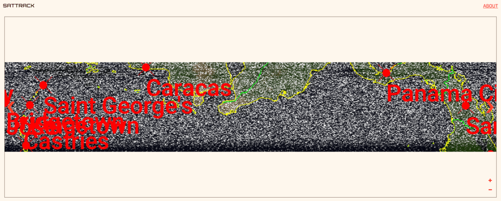
Project Website
https://sattrackenergy.netlify.app/
Project Code
https://github.com/ryrotella/sattrack
Technological Ecosystem
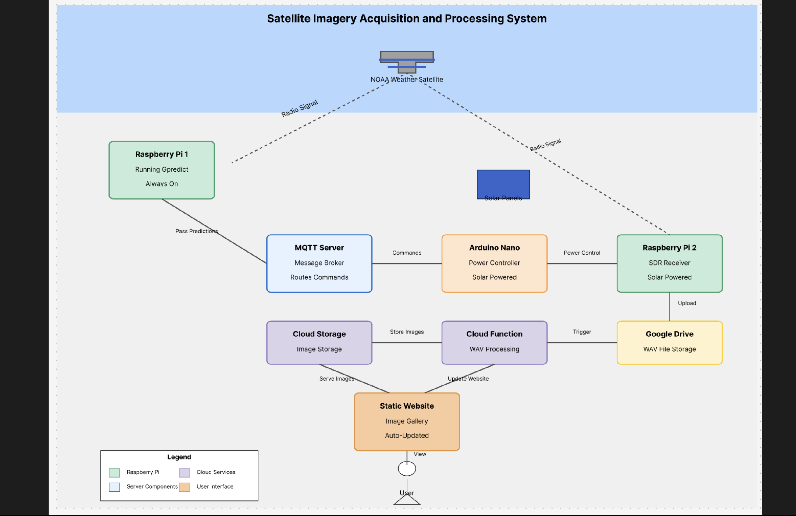
Order of Technical Operations
Raspberry Pi 1 – Tracker
This Raspberry Pi, which is located in a secure indoor setting (but could be moved outside to Solar in the future), is Always On and calculates the paths of satellites. If an NOAA 15/18/19 satellite is about to pass Brooklyn, NY, this Pi notifies our MQTT Server of an upcoming satellite so that the rest of our upcoming tech ecosystem wakes up and prepares to record the satellite.
MQTT Server
Our MQTT Server, which we set up on Shiftr.io, listens for JSON messages from the Tracker Raspberry Pi (Pi 1).
Arduino Nano 33 IOT
The Arduino lives in the Brooklyn Navy Yard and listens to our MQTT Server. Once a JSON message from the Tracker Pi is received, the Arduino turns on the second Raspberry Pi, which is physically connected to the Arduino in serial. While communicating the Pi, the Arduino also sends status messages back to the MQTT server (if the Field Pi is on, if a recording is successful/unsuccessful, etc.).
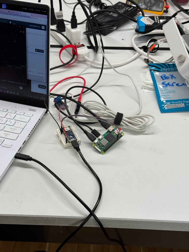
Raspberry Pi 2 – Field (Raspberry Pi 0 2W)
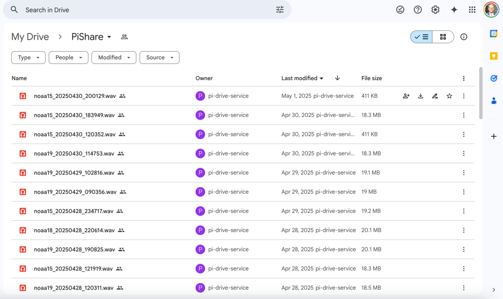
This Raspberry Pi, which is located outside at the Brooklyn Navy Yard, is powered by a Voltaic Solar Panel and Battery. This Pi also has an SDR-RTL USB antenna attached to it, which records satellites passing by when prompted by the Arduino. Once an NOAA satellite is recorded for the duration of the satellite’s pass (usually 15 minutes), this Pi uploads to a Google Drive folder linked via RClone.
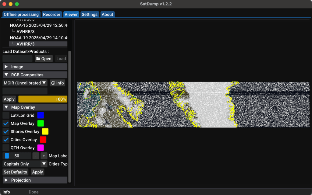
SatDump
To this point, everything in our tech ecosystem has been automatic and hands-off. We wanted to set up a Google Cloud Console function that would decode our satellite recordings once a file was uploaded, but due to time constraints, we could not achieve that.
Instead, we used the software, SatDump, to decode images manually and then manually upload decoded satellite images to our website.
SatTrack Website
Once all images were uploaded and tagged accordingly, we (mainly Surya) built our website using Node.js. A user can click on the “Decode Image” button. An animation triggers that reveals the image and plays a noise similar to what our .wav recordings sound like. A user can also scroll through our timeline view to see when we captured this satellite image and which satellite we accessed.

Process Journey
Will update with the debugging story and lessons soon!
Future Plans
Since our ecosystem is modular, we plan to take our assemblage of Raspberry Pis, Arduino, and Antenna to more remote location(s) and get clearer signals and cleaner recordings.
In the future, we could also add more satellites to our tracking and recording when we improve our antenna and recording capabilities. We could also add another solar panel wired to the battery so that our project can survive for longer periods of time (though it has survived for 2 weeks straight now!).

Leave a comment